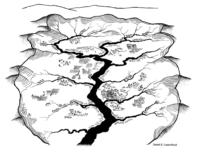
A watershed is like a basin or a bowl that is made up of land, with the higher spots (like mountains) being the edges. When precipitation falls on this land some of it moves down hill, gets to lower points and collects into small streams – each of which has its own watershed within the larger watershed. These streams, or subwatersheds, come together to form bigger and bigger streams, then rivers. And the central river drains directly into the ocean. So watersheds connect all of the land to the ocean.
The Penobscot River Watershed has a total drainage area of over 8,500 square miles, is centrally located within the borders of Maine and the largest watershed in the state. Surface waters within the Basin include 1,224 lakes and 188 named rivers and streams which total 7,127 river miles. Many of these waterways retain their Penobscot names.
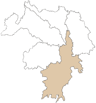
The river has five major subwatersheds:
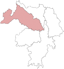
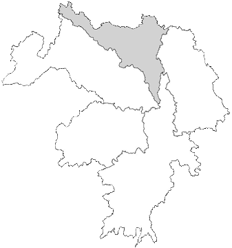
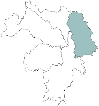
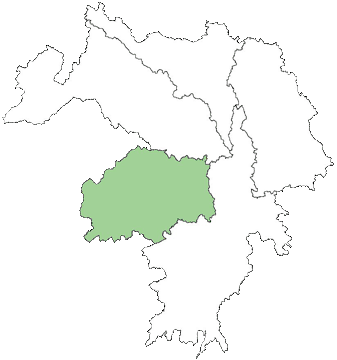
Penobscot River Watershed
Watershed-wide Issues:
- Approximately 114 dams are in place in the Penobscot River Basin.
- 12 of these dams are major hydropower projects and have generally poor fish passage.
- Four major dischargers discharge directly into reservation waters.
- Some known constituents being discharged include suspended solids, heat, oxygen depleting substances, chlorinated organics, chromium, copper, dioxin, lead, mercury, phenols, vanadium & zinc.
- Fish consumption advisories for mercury are in place for all waters in the basin.
- HoltraChem, a chlor-alkali plant closed in 2000, is located on the lower Penobscot. Sediments downstream contain the highest concentrations of mercury in Maine and possibly the country. The plant was licensed to discharge up to 5 pounds of mercury/year directly to the Penobscot River and hundreds of pounds/year into the air.
- Thermal loading throughout the entire watershed affects the migration/resting behaviors of mature adult salmon during spawning.
- Designated uses and toxics levels do not address Penobscot culture or concerns.
Area-specific Issues:
West Branch: This drainage is heavily manipulated for hydropower generation (contains the largest privately owned hydroelectric complex in the country), has historically received wastewater from two pulp and paper mills and continues to receive waterwater from two municipalities. Portions are listed as not attaining water quality standards (WQS) for bacteria, aquatic invertebrate communities and dissolved oxygen. Tribal data indicate significant algal/cyanobacteria blooms that have originated here and affected the entire main stem of the Penobscot downriver (~75 miles).
East Branch: Water quality standards are being met but the watershed, including pristine Grand Lake Mattagamon, is threatened by non-point source pollution. Sources include forestry activities (timber harvesting and associated roads) camps and other development.
Piscataquis River: This drainage is affected by discharges from two large municipal treatment plants, a textile mill, non-point source pollution from agricultural and forestry operations and at least six dams. Significant turbidity and suspended solids within the river is caused by erosion in or near poorly constructed haul roads, skid trails, and stream crossings. Excessive macrophyte and algae growth downstream of one treatment plant suggests the need for additional controls at the facility.
Lower Penobscot: Two kraft mills discharging here result in fish consumption advisories for dioxins, furans and PCBs. Several segments do not attain bacteria standards due to untreated residential and municipal combined sewage overflow wastes. Several tributaries do not attain water quality standards for dissolved oxygen because of agricultural activities. In recent years there have been problems with phosphorus loadings which have been addressed by setting wastewater permit limits.
Lakes and ponds on which we take measurements
There are many lakes and ponds on Penobscot Nation trust lands, many of which are affected by similar impacts and some of which have unique characteristics. Click on the name of each lake to view a Google map of it!
Matagamon Lake: This is one of northern-most lakes around which the Nation owns Trust lands and the deepest that the Program monitors. The northern entrance to Baxter State Park is a stone’s throw away from the shore. The water depth measures up to 100 feet in some locations. Lake levels are maintained/managed by a small dam on the stream that flows out of it. This lake also has the good fortune to have a lake association – http://www.katahdinoutdoors.com/dam/
Mountain Catcher Pond: This is the other northern-most lake around which the Nation owns Trust lands. It is located just northeast of Matagamon Lake and remains isolated. This pond’s greatest depth is only about 15 feet.
Salmon Stream Lake: This lake has very good water quality. It sits in a valley relatively close to Mount Katahdin and provides a beautiful foreground to the view from the scenic overlook on I-95. This pond’s greatest depth is only about 15 feet.
Upper Sysladobsis Lake: This lake’s greatest depth is about 40 feet.
East Branch Lake: This lake has the unfortunate status of seeming to be highly impacted by acid rain. The Water Resources Program has worked closely with the George Mitchell Center at the University of Maine to collect samples for analyzing the pH of the water here. This lake’s greatest depth is about 22 feet.
Mattamiscontis Lake: This lake’s greatest depth is about 40 feet.
Little Mattamiscontis Lake: This lake’s greatest depth is about 20 feet.
South Branch Lake: This lake’s greatest depth is about 20 feet.
Snow Mountain Pond: This is the highest elevation lake on Penobscot Nation Trust lands and the most shallow. This pond’s greatest depth is only about 8 feet.
Round Mountain Pond: This pond’s greatest depth is about 30 feet.
Blanchard Pond: This pond is unique because it is completely fed by an underground spring. The greatest depth is about 30 feet.